1
/
of
6
SMAJAYU
SMA20 Base 900MHz GNSS RTK GPS Surveying Equipment 1408 Channels, Work as Base Station for UAVs/Drones, Land Survey, Topographic Mapping, CORS/NTRIP Correction, Free Software, NOAA Certified
SMA20 Base 900MHz GNSS RTK GPS Surveying Equipment 1408 Channels, Work as Base Station for UAVs/Drones, Land Survey, Topographic Mapping, CORS/NTRIP Correction, Free Software, NOAA Certified
Regular price
$2,166.99 USD
Regular price
$6,498.99 USD
Sale price
$2,166.99 USD
Shipping calculated at checkout.
Quantity
Couldn't load pickup availability
Brand: SMAJAYU
Features:
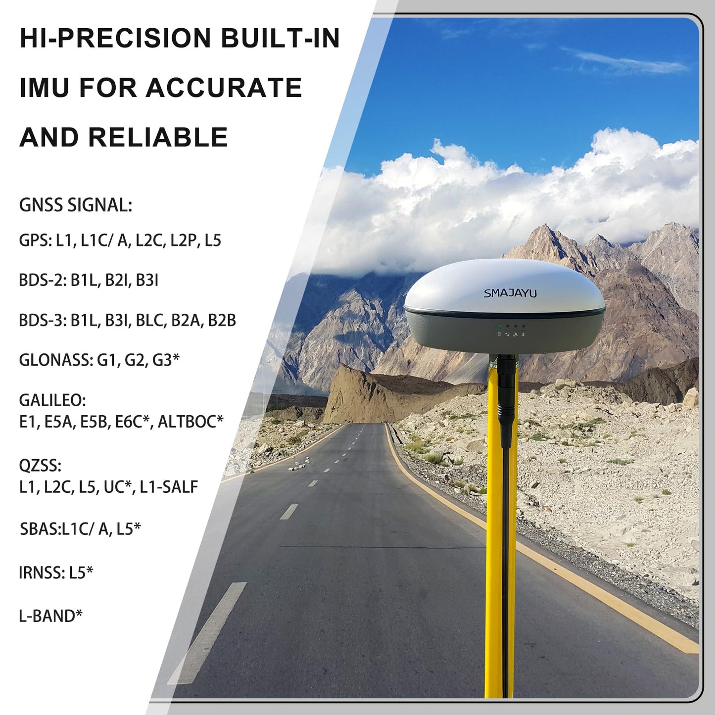
- Advantages: ① Static and Base dual mode simultaneously works, PPK surveying and PPK calculation on “SMA SURVEY” APP ②NOAA certification: SMA20RTK is antenna name of NOAA registered ③Compatible with SMA26 static for PPK. ④PPP method: PPP method by Galileo HAS correction; ⑤Rinex logging enabled which can export rinex files directly to PC; ⑥Ntrip network connection supported by login a CORS account on “SMA SURVEY” APP
- Capability: Full-Constellation, one GNSS receiver free switching between rover and base station. ①1cm RTK accuracy and 0.25cm static accuracy ; ②30°tilt 2.5cm accuracy (horizontal),max. angle 60°tilt, ; ③long endurance battery:10hours for base under continuous work of each battery charge; ④2.5cm accuracy by PPK method; ⑤2.5cm RTK accuracy by Ntrip network station ⑥Able to starting with fixed point to make sure higher accuracy
- Multiple Frequency, Offers higher accuracy and Stability,Stronger Resistance,Faster Convergence time Differential technology: RTK, PPP, PPK,Static Supported protocols: TRIMATLK, TRIMMARK Ill, TT450S, TRANSEOT, Satel 3AS 4FSK Frequency: 900Mhz
- Packing list Set: One gnss receiver and surveying software for android device(phone,tablet,collector). Excludes collector and tripod Activated 'SMA SURVEY' software included and free download.
model number: SMA20 Rover
Package Dimensions: 14.8 x 13.0 x 7.5 inches
Share